

Aljažev dom v Vratih - Triglav (General)
Tominškova pot
6 h 30 min




 Weather
 Nearest webcam


| Rating: | |
| Country: | Slovenia |
| Mountain range: | Julian Alps |
| Trailhead: | Aljažev dom v Vratih (1015 m) |
| Destination: | Triglav (2864 m) |
| Trailhead latitude/longitude: | 46.409 / 13.8435 |
| Destination latitude/longitude: | 46.3783 / 13.8366 |
| Difficulty: | Very difficult marked route  |
| Recommended equipment: | Hiking shoes Water Snack Helmet Self-protection kit |
From the Ljubljana–Jesenice highway, continue toward Kranjska Gora and exit the highway at Hrušica. Drive toward Mojstrana, where you’ll follow the signs for the Vrata Valley. In Mojstrana, continue along Triglavska Road toward the Vrata Valley. The road—paved at first, then gravel—leads past the Peričnik Waterfall to a well-maintained parking lot at the end of the valley, about 10 km from Mojstrana. It’s about a 5-minute walk from the parking lot to the Aljažev Dom mountain hut. Vehicle access is restricted, and parking is subject to a fee. If the parking lot is full, access may be closed. During the summer season, bus service is also available from Mojstrana. Before departing, check for current traffic restrictions and the bus schedule.
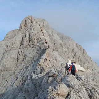
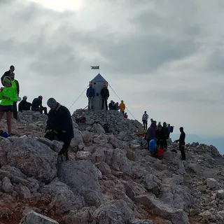
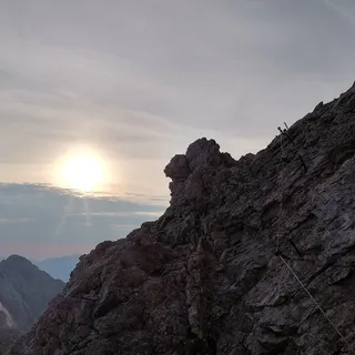
Trail description:FROM THE ALJAŽ HUT TO THE START OF THE TOMINŠKOVA TRAIL From the Aljaž Hut in Vrata, continue along the gravel path toward Triglav. After a few minutes, we reach a distinctive monument in the shape of a large climbing piton with a carabiner. Here, we leave the main trail through the valley and turn left onto the marked Tominškova Trail. We cross the Triglavska Bistrica stream, which may be dry, and begin a steep ascent through the forest. The trail quickly rises above the Vrata Valley and leads along the slopes below Cmir. Even in the lower section, the ascent is quite strenuous, and higher up, the terrain gradually changes into a rocky high-mountain landscape. ASCENT VIA THE TOMINŠKOVA TRAIL Above the tree line, the trail becomes increasingly exposed. On the more challenging sections, pitons, bolts, and steel cables have been installed to assist in navigating the rocky passages. In some places, the trail crosses narrow ledges and steep slopes, where a surefooted stride and a head for heights are essential. As you ascend, views open up of Triglav’s north face, the Vrata Valley, and Škrlatica. Snow may linger in certain ravines even during the warmer months, so it’s important to check conditions before setting out. FROM THE JUNCTION OF THE TRAIL ACROSS PRAG TO KREDARICA After completing the most challenging section of the Tominšek Trail, we join the trail coming from the Vrata Valley across Prag. A little higher up, you’ll reach Begunjski studenec below the cliff face of Begunjski vrh. Since the availability of water is not guaranteed, be sure to bring a sufficient supply of drinking water. We continue along the marked trail to the next fork, where we turn right toward the Triglav Lodge at Kredarica, while the left path leads to the Valentin Stanič Lodge. The trail then takes us across the rugged karst landscape of the Triglav foothills, where extra caution is needed when navigating, especially in fog. After a further ascent, we reach the Triglav Lodge on Kredarica (2,515 m), where we can rest before the final ascent. FROM KREDARICA TO TRIGLAV From the hut, we first descend slightly toward the base of Mali Triglav. This is followed by a steep, secured rock climb, aided by steel cables and pitons. Once we reach Mali Triglav, we continue along a narrow and very exposed ridge toward the main summit of Triglav. Constant attention is required here, especially when encountering other hikers. At the summit of Triglav (2,864 m) stands the famous Aljaž Tower. On a clear day, a sweeping view of the Julian Alps and the surrounding mountain ranges opens up.
Additional tips:- This route is suitable only for experienced and physically fit climbers who are accustomed to very demanding, secured routes and exposed terrain. Appropriate equipment (helmet, self-belay kit) and knowledge of how to use it are required. - Extra caution is required on exposed rock sections, wet rock, snowfields, and in conditions of poor visibility. In the presence of snow and ice, additional winter gear and appropriate skills may be necessary. - Before setting out, check the weather forecast, the condition of the hiking trails, and current conditions in the high mountains. Postpone the ascent if there is a risk of storms or adverse conditions. - To descend into the Vrata Valley, you can choose the route via Prag, which is also challenging and partially secured. The descent via the Tominšek Trail is particularly challenging due to its steepness and exposure. - Allow significantly more time for the entire hike than for the ascent alone. Factor in fatigue, potential delays on the summit ridge, and ensure you return to the valley early enough.