



Planina Srednica - Planina Srednica (General)
Krožna pot: Planina Lašca - Izvir Tolminke
4 h 30 min




 Weather
 Nearest webcam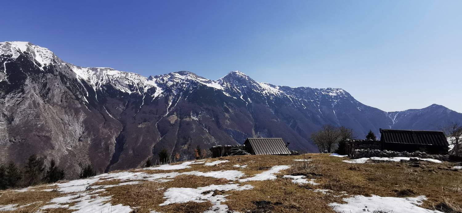
| Rating: | |
| Country: | Slovenia |
| Mountain range: | Julian Alps |
| Trailhead: | Planina Srednica (430 m) |
| Destination: | Planina Srednica (430 m) |
| Trailhead latitude/longitude: | 46.2381 / 13.7232 |
| Destination latitude/longitude: | 46.2381 / 13.7232 |
| Difficulty: | Difficult marked route  |
| Recommended equipment: | Hiking poles Hiking shoes Water Snack |
Drive into Tolmin and at the main traffic lights turn towards the village of Zatolmin. Once in Zatolmin, turn right after the Zatolmin guesthouse towards Tolminski korite. From here, drive just a few dozen metres and turn left at the next possible fork, just before the Gugala cheese factory. From here on, stick to the road, which becomes a dirt road behind St Peter's Church. A longer drive through the forest follows, which after about half an hour brings us to a fork where the road to Sv. Duh na Javorci branches off to the left, and we continue straight on for a few more tens of metres until we reach the roadblock in front of which we park.
Trail description:On foot, continue along the road that leads past the barrier towards the Polog mountain. At Polog continue along the road until you reach a small forest, where a less visible path branches off to the left. Turn here and follow the grassy track into the forest. Then walk through the forest on the path, which is sometimes less visible. Follow the small stones until you reach a scree field, which is located out of the forest. Cross the scree, after which the path starts to climb steeply and continues to climb for a longer period of time. Just before you reach the Lašca mountain, the grassy areas start to open up and you get wonderful views towards the high mountains. Then we will reach the mountain, which is mostly flat, for a short distance. The way down is on the other side of the mountain. It soon turns into a forest and begins to descend. When you come out of the woods, there is a section of the path that leads over stones. The path is a bit more dangerous in some parts and is also protected by wooden logs. After a long descent, you will reach a crossroads. Keep to the descending path (do not continue towards Prehodce). Continue descending. As the path lays down, it leads into a small wood and soon splits again. Turn right and walk across the stream. On the other side of the river there will be another crossroads where you continue towards Tolmin. Cross a pasture meadow and you will reach the source of the Tolminka River. Follow the trail past the local hunting lodge. The path first climbs a few metres and joins a wider track. Turn left and start a winding descent towards the Polog mountain. From here it is only a few minutes' walk to the starting point.
Additional tips:No additional tips.
![[object Object] - [object Object] main photo](https://api.mountainsgeek.com/media/20180616_071826_HDR.jpg)
![[object Object] - [object Object] main photo](https://api.mountainsgeek.com/media/20180616_085130_D8ZbkHq.jpg)
![[object Object] - [object Object] main photo](https://api.mountainsgeek.com/media/20180616_110522.jpg)
![[object Object] - [object Object] main photo](https://api.mountainsgeek.com/media/20180616_113342_gepEldU.jpg)
![[object Object] - [object Object] main photo](https://api.mountainsgeek.com/media/20180616_143152_f0vA8iW.jpg)
![[object Object] - [object Object] main photo](https://api.mountainsgeek.com/media/20180616_072557n_0z56dHU.jpg)
![[object Object] - [object Object] main photo](https://api.mountainsgeek.com/media/20180616_115653%C5%BE%C5%BE%C5%BE%C5%BE%C5%BE%C5%BE%C5%BE%C5%BE%C5%BE%C5%BE%C5%BE%C5%BE%C5%BE%C5%BE%C5%BE%C5%BE%C5%BE%C5%BE%C5%BE.jpg)
![[object Object] - [object Object] main photo](https://api.mountainsgeek.com/media/20190518_084857.jpg)
![[object Object] - [object Object] main photo](https://api.mountainsgeek.com/media/IMG_20191225_112944.jpg)
![[object Object] - [object Object] main photo](https://api.mountainsgeek.com/media/IMG_20191225_095226.jpg)
![[object Object] - [object Object] main photo](https://api.mountainsgeek.com/media/IMG_20191225_101922.jpg)
![[object Object] - [object Object] main photo](https://api.mountainsgeek.com/media/IMG_20191225_110105.jpg)
![[object Object] - [object Object] main photo](https://api.mountainsgeek.com/media/20180616_063441_9f17RkC_FrYkOFf.jpg)
![[object Object] - [object Object] main photo](https://api.mountainsgeek.com/media/IMG_20191225_104421.jpg)
![[object Object] - [object Object] main photo](https://api.mountainsgeek.com/media/IMG_20200411_113625.jpg)
![[object Object] - [object Object] main photo](https://api.mountainsgeek.com/media/IMG_20211002_102310.jpg)
![[object Object] - [object Object] main photo](https://api.mountainsgeek.com/media/IMG_20211002_093246.jpg)
![[object Object] - [object Object] main photo](https://api.mountainsgeek.com/media/IMG_20200411_113609_eM0ZW8h.jpg)
![[object Object] - [object Object] main photo](https://api.mountainsgeek.com/media/IMG_20211002_091505_WLqqDb3.jpg)


