



Cerje (Cirje) - Lisca (General)
0 h 45 min




 Weather
 Nearest webcam
| Rating: | |
| Country: | Slovenia |
| Mountain range: | The Zasavje-Posavje Hills and the Dolenjska Region |
| Trailhead: | Cerje (Cirje) (640 m) |
| Destination: | Lisca (948 m) |
| Trailhead latitude/longitude: | 46.0631 / 15.2848 |
| Destination latitude/longitude: | 46.068 / 15.2848 |
| Difficulty: | Easy marked route  |
| Recommended equipment: | Hiking poles Hiking shoes |
In Sevnica, take the third exit at the roundabout by the "RONDO" pub, coming from the direction of Boštanj. If you are coming from Sevnica, take the first exit. Continue driving along the road leading to Planina pri Sevnici until you reach the wine cellar "MASTNAK", which is located on the left side of the road in the direction of travel. Turn left here and drive up the hill to the first crossroads (not a road turnoff) and turn left at the crossroads. Continue along the road to the second road junction to the right and turn right here. At this junction there is a sign for a "climbing route". Continue for about 1 km to a parking area next to a small water intake. Park your vehicle here.
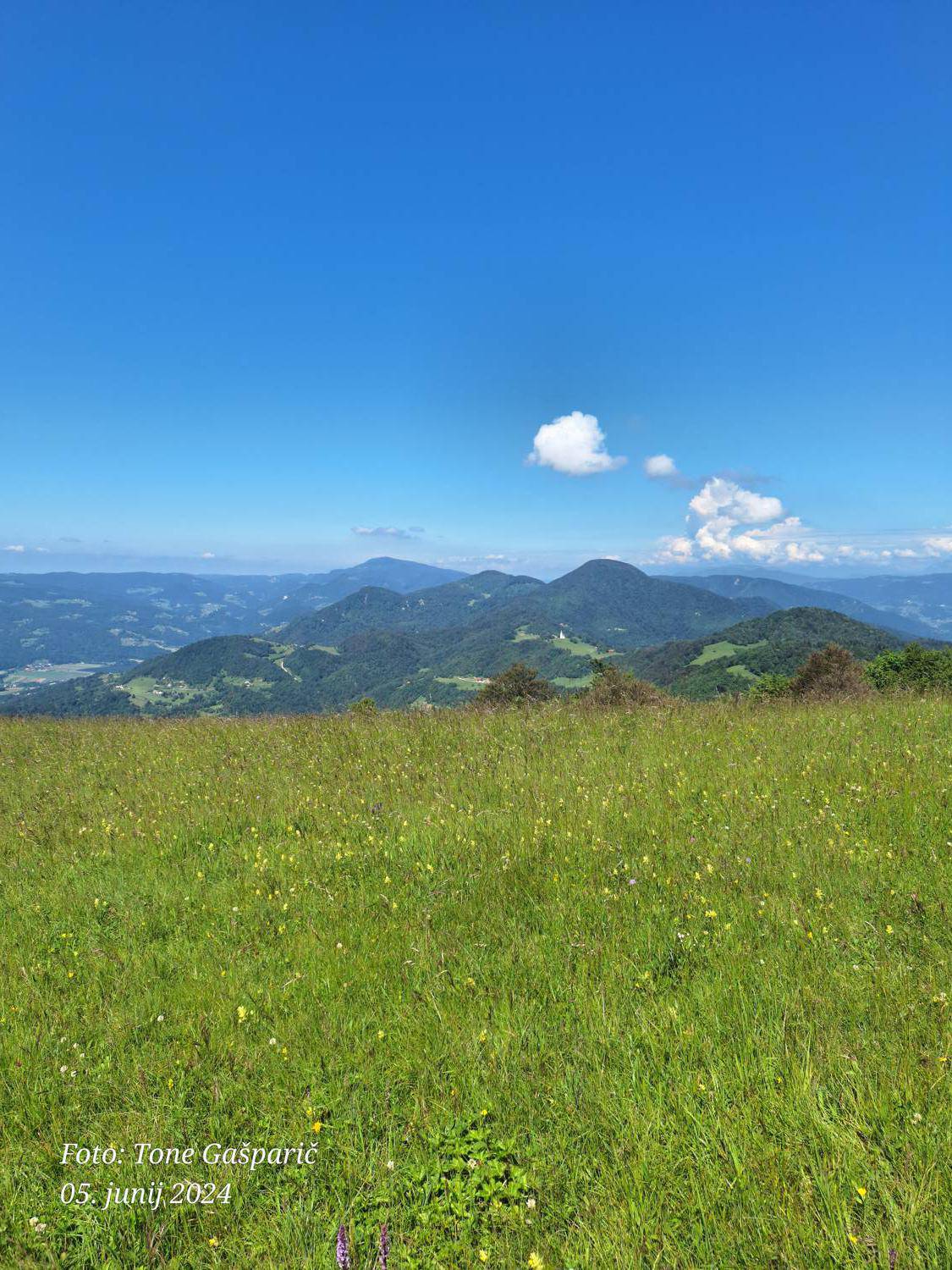
Trail description:From the parking area, pass by a small water intake, where there are mountain signs, and continue along the asphalt road, which soon turns into a macadam road. After a few metres of walking on macadam, turn left at the rock, where there are also mountain signs, onto the Pastirček path, which also leads to a climbing trail. After about 1 km of walking, we join a steep path called "over the rocks", and here there is also a beautiful view of the Sava valley. Continue along the path and after about 100 m, the path leading to Lisca past the Church of St. Roko joins from the left. After a few metres, the top of Lisca is visible. On reaching the clearing, you can turn left and go to the top past the "bench of love", where there is a beautiful view and, in good weather, you can see all the way to Triglav. The top of Lisca is about 200 m away and there is a point and a weather station, as well as a Slovenian flag on the top.
Additional tips:To return to the starting point, you can either take the arrival route or take a circular route, following the unmarked "sun route". In this case, the circular route is just over 5 km long. If you choose the circular route, you will descend from the top of Lisca to the parking area, then follow the asphalt road leading to Lisca to the first turning on the right and follow the macadam road to the starting point. This is the so-called "SUNNY ROUTE".
![[object Object] - [object Object] main photo](/assets/images/default-no-image.webp)
![[object Object] - [object Object] main photo](https://api.mountainsgeek.com/media/IMG_20200101_122731.jpg)
![[object Object] - [object Object] main photo](https://api.mountainsgeek.com/media/1000002828_YnCwyyz.jpg)
![[object Object] - [object Object] main photo](https://api.mountainsgeek.com/media/1000002866.jpg)


