



Volarje - Gregorčičev slap (General)
2 h 0 min




 Weather
 Nearest webcam
| Rating: | |
| Country: | Slovenia |
| Mountain range: | Julian Alps |
| Trailhead: | Volarje (181 m) |
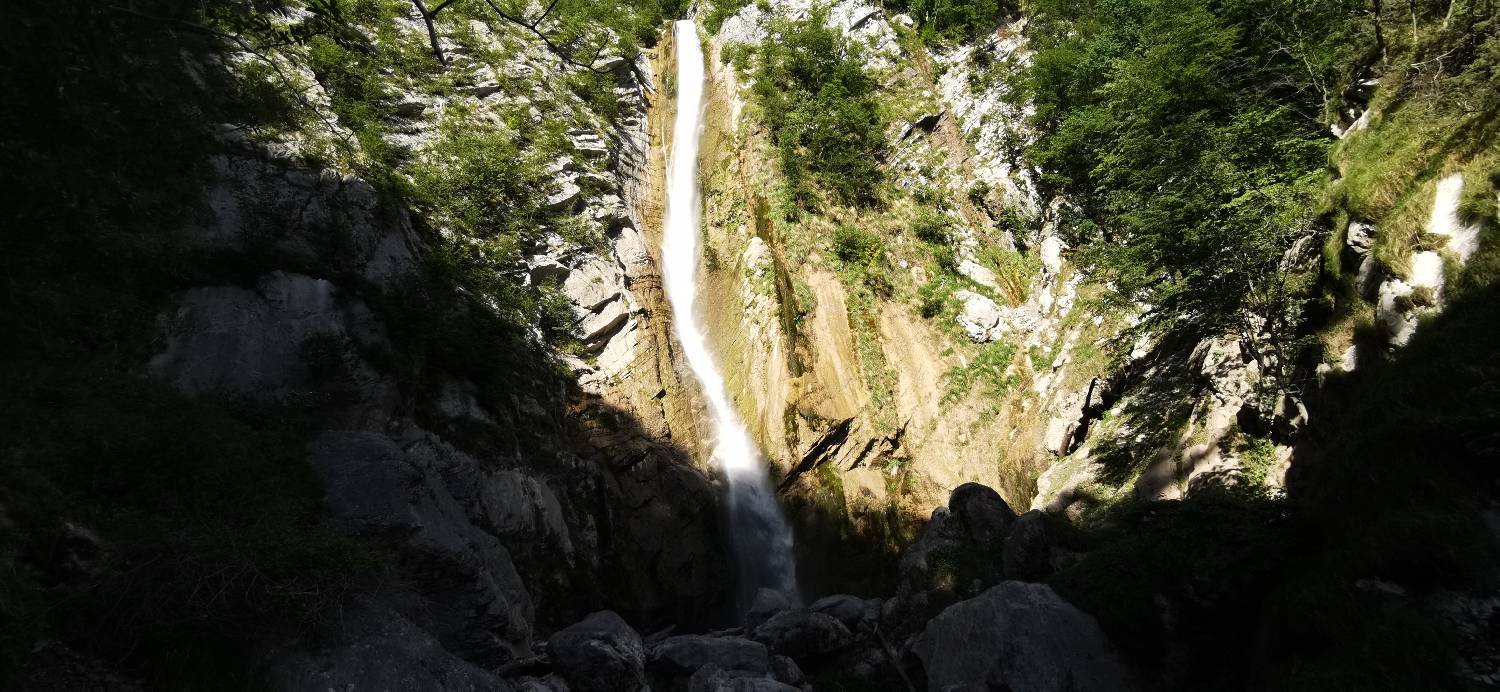
| Destination: | Gregorčičev slap (390 m) |
| Trailhead latitude/longitude: | 46.207 / 13.6722 |
| Destination latitude/longitude: | 46.2241 / 13.6594 |
| Difficulty: | Difficult unmarked route  |
| Recommended equipment: | Hiking poles Hiking shoes Water Snack |
From Tolmin, head toward Kobarid. Drive to the turnoff for Volarje, where you’ll turn right and cross the Volarje Bridge. Park in the parking lot at the end of the bridge.
Trail description:From the parking lot, head toward the dirt path located at the end of the lot. Walk along the dirt path, which runs right alongside the Soča River, all the way to the gravel road, where you’ll join it and turn left. You’ll then walk through some woods and pass a cabin marked by garden stakes. Continue into the village until you reach the main road, where you’ll turn left. Walk along the road to the bridge, cross it, and join the narrower trail on the right. Continue along the trail, which begins to climb immediately. After a short climb, we reach a pasture, which we cross to join a cart track, along which we continue walking. From here on, the terrain is mostly flat. Continue walking to the houses, where you’ll join the road and follow it to the Selce parking lot. From here, continue along the road, which descends slightly at first, and immediately afterward turn left, as indicated by the signpost. You’ll then step onto a dirt road, which leads into the forest. As soon as we enter the forest, the trail begins to descend steeply. We continue this way for quite some time until we reach a stream, which we cross. There is a fork in the trail here; we keep to the right. From here on, the trail begins to climb. The ascent first goes through the forest and then over a scree slope. When the trail leads back into the forest, it begins to descend steeply again and takes us to the lower, smaller waterfall. From here, you’ll need to climb steeply over the rocks, secured by steel cables and ropes. After that, there’s just a short walk along a forest trail, and you’ll reach your destination.
Additional tips:No additional tips.
![[object Object] - [object Object] main photo](https://api.mountainsgeek.com/media/IMG_20200526_174541_FY5e4RE.jpg)
![[object Object] - [object Object] main photo](https://api.mountainsgeek.com/media/IMG_20200526_174541_1sMXjry.jpg)
![[object Object] - [object Object] main photo](https://api.mountainsgeek.com/media/IMG_20200526_174147_6Q3zXX4.jpg)


