



Sovodenj - Sovodenj (General)
krožna pot - Koča na Ermanovcu, Bevkov vrh, Sivka
7 h 30 min




 Weather
 Nearest webcam
| Rating: | |
| Country: | Slovenia |
| Mountain range: | The Škofja Loka and Cerkno Hills and Jelovica |
| Trailhead: | Sovodenj (592 m) |
| Destination: | Sovodenj (592 m) |
| Trailhead latitude/longitude: | 46.085 / 14.0389 |
| Destination latitude/longitude: | 46.085 / 14.0389 |
| Difficulty: | Easy marked route  |
| Recommended equipment: | Hiking shoes Water |
From Ljubljana, we’ll drive toward Tolmin, taking the old road past Škofja Loka. After about an hour’s drive, we’ll arrive in the village of Sovodenj. Along the way, we’ll soon notice a small Mercator store on our left, and a little further on, a larger parking lot where we’ll park.
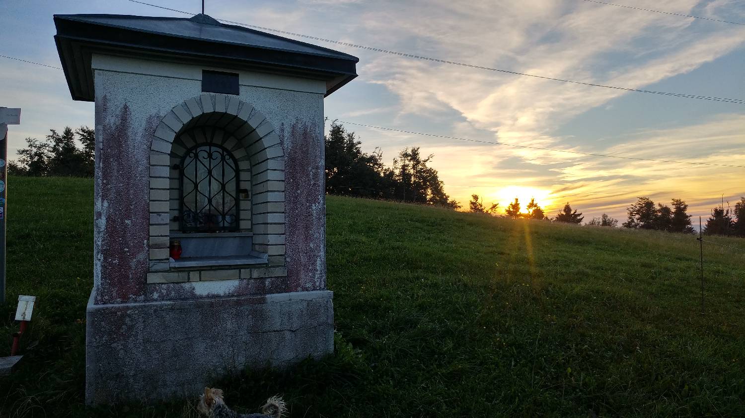
Trail description:From the parking lot, head toward Kladje, which means turning left onto the main road. There is no sidewalk along the road, so you’ll have to walk a short stretch on the road. Shortly after starting your walk, you’ll leave Sovodenj behind and pass a few houses on your left. Beyond the houses, at a bend in the road, you’ll notice another large house on your right, and to the right of it, a narrower road branching off from the main road. We cross the main road and continue along this narrower road, which is also indicated by a signpost. From here on, we continue along the road for quite some time, passing several forks in the road. We’ll also pass a small hamlet with a few houses; shortly after that, the road will begin to climb slightly, and a forest path will branch off to the left, which also leads to Ermanovec. We do not turn here, but instead continue for about 100 meters until we reach a sharp bend, where a forest trail branches off to the left again; we take this trail. We’ll walk through the forest, which runs alongside a small stream for quite some time, then crosses it at one point and leads us to a flat area in two bends. We continue for a short while across level ground, after which the trail leads us out of the forest, climbs across a meadow, and brings us to a paved road that runs through a small hamlet. On the road, turn right and continue up the ascending road to the Ermanovec hut. (The Slovenian Mountain Trail stamp is located behind the hut.) From the Ermanovec hut, we continue for about another kilometer along the paved road, which takes us up the grassy slope of Ermanovec toward the Vrhovec farm. At the farm, take the right-hand path toward the summit of Šanc (1,048 m), where there are some traces of Roman fortifications. The trail climbs gently from the farm to the summit of Šanc. From the summit of Šanc, we continue toward the Laniščar farm, passing the dilapidated former Italian military barracks on the left. After about a 10-minute walk, you’ll reach the Laniščar farm. From Laniščar, continue along the paved road, which descends gently, all the way to the hamlet of Kladje. There, we cross the main road connecting Sovodenj and Cerkno, and after a few meters, we turn left into a beech forest. The trail climbs gently up to a plateau with the Slamovčan farm below the trail. Following a flat dirt track, we reach the road, where we turn right and then immediately left at the intersection. We follow the road to the next intersection, where we turn left again onto the road that descends to the Veharše Pass. From the Veharše Pass, take the road on the right to the Ravan farm (Cerkljanski Vrh 24). From here, it’s about another 30 minutes to the chapel. Continue past the hayrack along a grassy cart track toward the summit, which you can see ahead. After a few minutes, the cart track turns right toward the forest. You’ll reach a sharp bend, and from there, the path climbs gently upward to a meadow. A signpost directs you onto a trail along the grassy slope, which leads you up a fairly steep ascent to the chapel on the northwest side of Bevkov Vrh, where you’ll also find the stamp for the Slovenian Mountain Trail. To reach the official summit, continue straight ahead from the chapel, past a small grove and then slightly to the right along a path that leads us across a meadow and then back into the forest, where a large concrete marker indicating Bevkov Vrh stands. From the chapel, continue toward Bevkov Vrh, but soon turn right and descend past a large abandoned farm to a cart track, which you’ll cross. From here, follow the trail markers and the clearly visible path toward Jazna. At first, the trail leads across grassy slopes, then soon enters the forest. After about 20 minutes of walking, you’ll reach a paved road for the first time; follow it to the right for less than a kilometer, then turn right again onto a trail that leads down to a paved road and an intersection above Jazna. Here, a red hiking sign will direct us left toward Sivka. We’ll follow the paved road to the first fork, where there are two houses on either side of the road. The trail toward Sivka branches off to the right here. The path is initially still paved and leads past a house on the left, then continues for a few hundred meters on flat ground, after which it climbs and passes another house. Immediately past this house, the road forks, becomes a gravel road, and turns into the forest. Take the right fork and continue along the relatively gentle road to another fork, where you turn left onto an ascending road that leads up to the meadows. Here we find ourselves at another fork, where we turn right; just a few dozen meters beyond it, a signpost for Sivka directs us onto a grassy cart track. The cart track slopes steeply and continues through the forest for quite some time. When we emerge from the woods again, the path levels out and we find ourselves in front of a farm, which we bypass on the right. This is followed by a walk across level terrain, which initially runs along the edge of the forest, then re-enters the forest and leads us through it to another farm. Here, we turn left and continue along a grassy path for quite some time, keeping straight the entire way. When we reach the paved road, we turn right and follow the road past a large building on the left and on to an intersection, where there is a table with benches and a small chapel. Here, take the middle, gravel path—which is also indicated by a signpost for Sivka—and continue gently uphill along the gravel path until you reach the edge of the forest. Here, a forest trail branches off to the right; take this trail uphill, and after about a 5-minute walk, you’ll reach the summit, located in the middle of the forest. From the summit of Sivka, head back down to the paved road and continue along it all the way back to the fork where you previously joined the paved road. From there, continue along the paved road (about 5 km) all the way to Sovodnje.
Additional tips:No additional tips.
![[object Object] - [object Object] main photo](https://api.mountainsgeek.com/media/20180406_182808_USv57uM.jpg)
![[object Object] - [object Object] main photo](https://api.mountainsgeek.com/media/20181202_162432_9tBK7r5.jpg)


